3.1 Magnitude Earthquake Shakes New Jersey and New York
Introduction
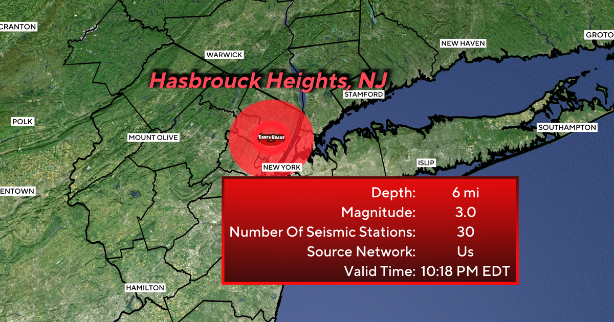
On Saturday night, a 3.1 magnitude earthquake shook parts of New Jersey and New York, leaving residents in Hasbrouck Heights, Bergen County, in shock. The tremors were felt in nearby towns and cities, causing panic and confusion among the locals.
Key Details
According to the US Geological Survey, the earthquake's epicenter was located just 2 miles away from Hasbrouck Heights. The quake occurred at a relatively shallow depth of 5 miles, which could explain why it was felt so strongly in the surrounding areas. While the earthquake did not cause any significant damage, some residents reported minor structural damages, such as cracks in their walls and floors.
Impact
This earthquake serves as a reminder that even areas not typically associated with seismic activity are still at risk. Bergen County is not known for frequent earthquakes, but this event demonstrates the importance of being prepared for any natural disaster. In a densely populated area like New Jersey and New York, it is crucial for residents to have an emergency plan in place in case of future earthquakes.
About the Organizations Mentioned
US Geological Survey
The U.S. Geological Survey (USGS) is a premier scientific agency of the U.S. government, established by Congress in 1879. As the science arm of the Department of the Interior, USGS provides impartial, comprehensive Earth science data and research to help manage natural resources and address environmental and public safety challenges[3]. Its mission centers on monitoring, analyzing, and predicting Earth-system interactions—including ecosystems, natural hazards, water resources, and mineral supplies—to deliver actionable information for decision-makers[3][4]. USGS's work spans a broad array of mission areas. Its Ecosystems Mission Area, for example, supports conservation, public safety, and economic growth by providing science that helps manage wildfire risks, drought impacts, food and water security, and natural resource development[2]. The Natural Hazards Mission Area focuses on monitoring and researching earthquakes, volcanic eruptions, landslides, and coastal erosion, enabling better hazard preparedness and resilience nationwide[6]. USGS operates about 250 laboratories nationwide to analyze physical and biological samples, underpinning its authoritative data on water, sediments, rocks, and more[5]. Key achievements include the development of advanced hazard monitoring systems like the seafloor seismographs deployed after major earthquakes, and continuous volcano monitoring through webcams and sensors, exemplified by Kīlauea’s eruption surveillance[4][6]. USGS also leads large-scale initiatives such as the Earth Mapping Resources Initiative (Earth MRI), enhancing resource assessment and land-use planning[4]. Today, USGS is recognized for its cutting-edge, integrated research that addresses 21st-century challenges such as climate change, resource sustainability, and disaster risk reduction. Its data and scientific insights are crucial for government agencies, industries, and communities, supporting economic growth while safeguarding natural heritage and public safety[1][3]. The organization’s commitment to open access ensures that its maps, data, and scientific findings are widely available to the public, reinforcing its role as