Possible Tornadoes and Severe Storms Heading Towards Iowa
Introduction
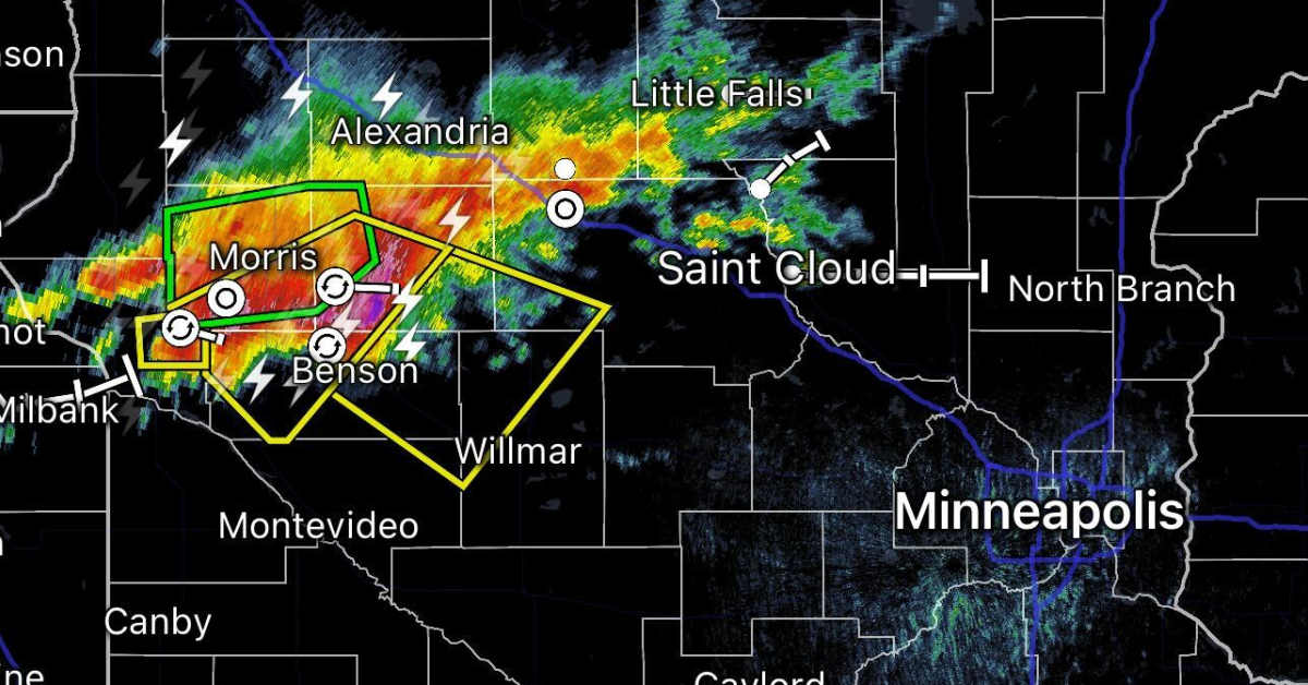
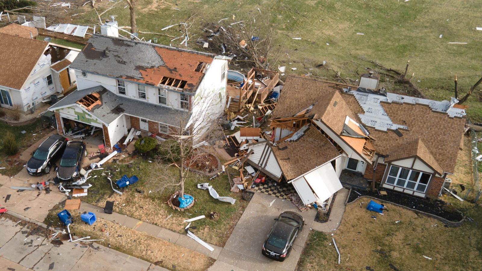
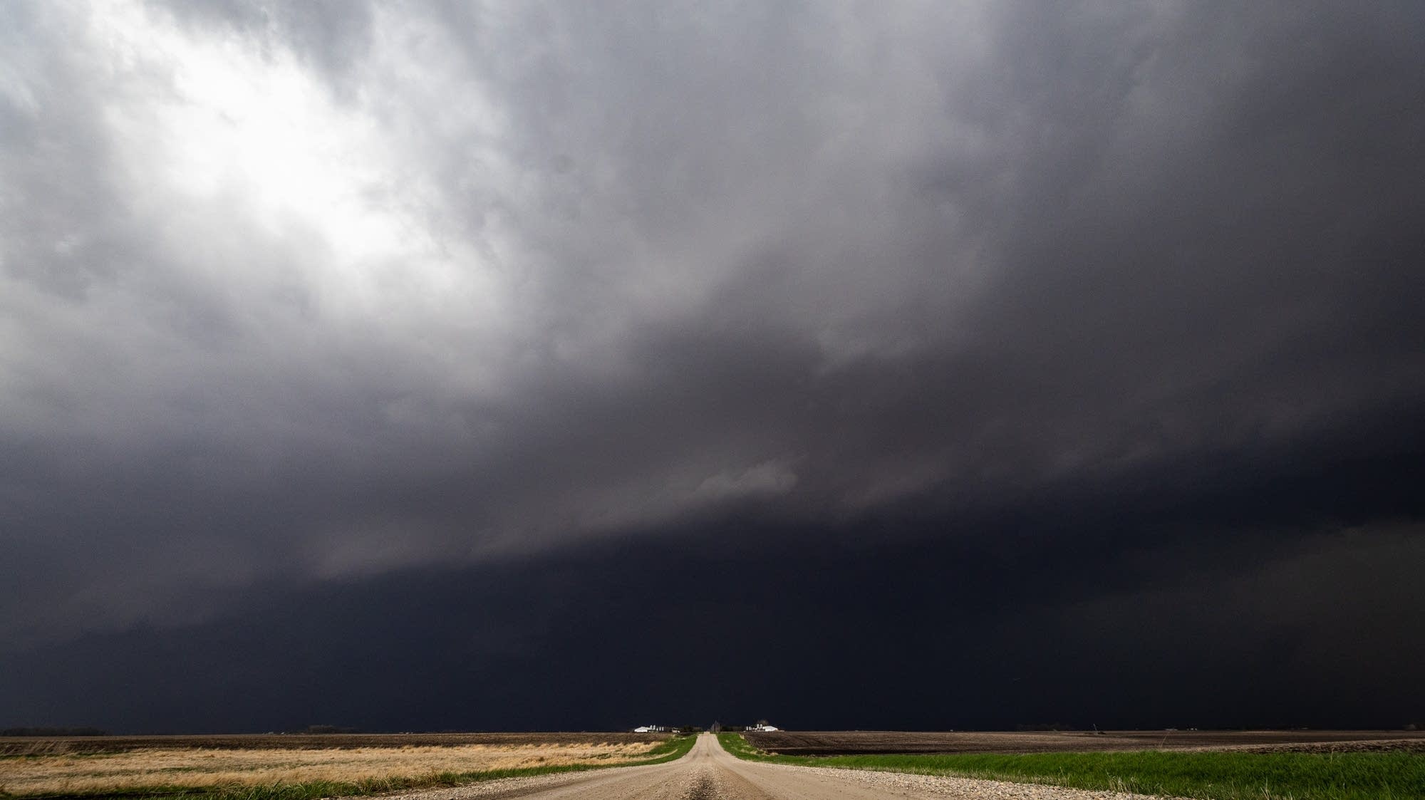
Residents of the metro area were in for a wild evening as severe thunderstorm warnings swept through the region. But it seems that the worst may be yet to come, as a more damaging line of storms is tracking into Iowa from South Dakota. This line of storms has the potential to produce tornadoes, making it a major cause for concern.
Key Details
The National Weather Service has issued a tornado watch for parts of South Dakota and Iowa, as well as a severe thunderstorm watch for the metro area. This is due to a strong cold front moving through the region, colliding with warm and humid air. This creates the perfect conditions for severe storms to form. The line of storms heading towards Iowa has already produced damaging winds and large hail in South Dakota, causing power outages and property damage.
Impact
The potential for tornadoes in Iowa is a major concern, as they can cause catastrophic damage and put lives at risk. It is important for residents to stay informed and take necessary precautions to stay safe during this weather event. The National Weather Service advises people to stay indoors and away from windows, and to have a safety plan in place in case of a tornado warning. It is also important to keep an eye on local news and weather updates for any changes or developments in the storm. Stay safe, and be prepared for the worst.
About the Organizations Mentioned
National Weather Service
The **National Weather Service (NWS)** is a U.S. federal agency under the National Oceanic and Atmospheric Administration (NOAA) dedicated to providing weather, hydrologic, and climate forecasts and warnings across the United States, its territories, and adjacent waters. Its primary mission is to protect life and property and enhance the national economy by delivering timely, accurate, and science-based environmental predictions[1][2][5][6]. Founded in the late 1800s, the NWS has evolved into a comprehensive weather monitoring and forecasting organization. It operates through a nationwide infrastructure comprising 122 Weather Forecast Offices (WFOs), 13 River Forecast Centers (RFCs), and 9 specialized national centers including the National Hurricane Center, Storm Prediction Center, and Space Weather Prediction Center, among others[1][3][4]. These centers utilize advanced technology such as Doppler radars (WSR-88D), satellite data, automated surface observing systems, and sophisticated computer models to gather and analyze atmospheric data continuously[7]. Key achievements of the NWS include the development of impact-based decision support services that aid emergency management, aviation, marine operations, and the general public in preparing for hazardous weather events. The agency issues around 1.5 million forecasts and 50,000 warnings annually, significantly contributing to disaster preparedness and response efforts[4][6]. The 2011 Strategic Plan emphasizes building a “Weather-Ready Nation” by leveraging advancements in science and technology to anticipate future service needs and improve societal resilience to weather-related threats[4]. Currently, the NWS employs about 4,800 staff members and operates with a budget nearing $930 million. Its organizational structure includes a Chief Information Officer, Chief Financial Officer, and multiple operational and scientific divisions that ensure continuous innovation and service improvement. The agency’s commitment to integrating hydrologic and climate data with weather forecasting positions it as a critical player in environmental intelligence, supporting both governmental and private sectors[2][3][5