Hurricane Erin Prompts Evacuation Orders in North Carolina
Introduction
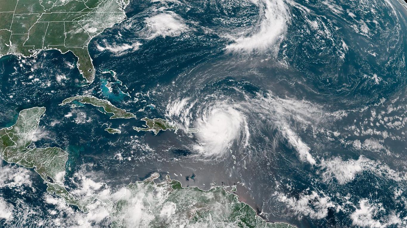
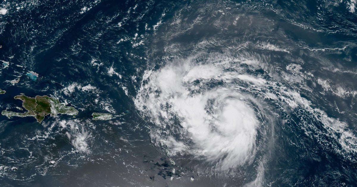
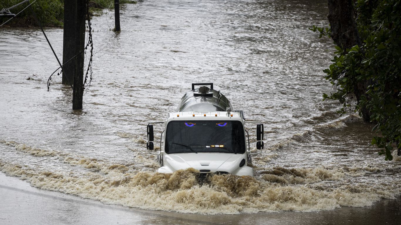
Hurricane Erin has prompted evacuation orders along the North Carolina Outer Banks. While the U.S. was not expected to experience a direct hit, the storm has the potential for "life-threatening impacts." As a result, Dare County has issued an evacuation order for the area.
Evacuation Orders
Dare County's order comes as no surprise, as the county is no stranger to hurricanes. In 2018, Hurricane Florence brought devastating floods to the area, causing widespread damage. Residents and visitors alike are urged to take this evacuation order seriously and leave the area as soon as possible.
Potential Impacts
While the storm's path is still uncertain, officials are taking precautions to ensure the safety of those in its potential path. In addition to the evacuation order, the National Hurricane Center has issued a hurricane watch for parts of the North Carolina coast. With winds expected to reach up to 74 mph, residents and tourists should brace for potential power outages and storm surges.
About the Organizations Mentioned
Dare County
Dare County, located in northeastern North Carolina along nearly 110 miles of the Outer Banks shoreline, is a significant coastal region known for its historical and cultural heritage, tourism, and natural beauty[1][8]. Established in 1870 from parts of Tyrrell, Currituck, and Hyde counties, it is named after Virginia Dare, the first English child born in the Americas, symbolizing its deep historical roots tied to early English colonization and the Lost Colony of Roanoke Island[2][3][4]. The county seat is Manteo, a town named after a Native American chief who aided early settlers, and the county comprises six municipalities including Kill Devil Hills, Kitty Hawk, and Nags Head[1][2]. Its geography includes Roanoke Island, extensive beaches, and protected areas such as Cape Hatteras National Seashore and multiple wildlife refuges, making it a hub for environmental conservation and outdoor recreation[1][3]. Dare County is renowned for its tourism industry, which is a major economic driver. In 2023, visitor spending exceeded $2.15 billion, ranking it fourth in tourism revenue among North Carolina’s 100 counties[7]. The area attracts over 300,000 weekly visitors during peak summer seasons, drawn by attractions such as the Wright Brothers National Memorial, Fort Raleigh National Historic Site, and the North Carolina Aquarium[1][7]. This influx supports a vibrant local economy focused on hospitality, retail, and services. With a population nearing 37,000 as of 2025 and steady growth over recent years, Dare County balances a small permanent population with a large seasonal tourist presence[2][6][9]. The governance follows a Commissioner/Manager model, managing resources and community development while preserving the county’s unique heritage and environment[1]. Notably, Dare County holds a distinctive place in American history and innovation, celebrated for its role in early colonization and as the site of the Wright Brothers' first powered
National Hurricane Center
## Overview The National Hurricane Center (NHC), a division of the National Oceanic and Atmospheric Administration (NOAA), is the primary U.S. agency responsible for monitoring, forecasting, and issuing warnings about tropical cyclones—including hurricanes and tropical storms—in the Atlantic and Eastern Pacific basins[1][3][6]. Headquartered on the campus of Florida International University in Miami, Florida, the NHC’s mission is to save lives, mitigate property loss, and improve economic efficiency by providing accurate, timely, and actionable information to the public, emergency managers, businesses, and international partners[1][2][4]. ## What the NHC Does The NHC operates 24/7, maintaining a continuous watch on tropical weather systems. Its Hurricane Specialist Unit (HSU) issues forecasts, advisories, and warnings, including the Tropical Weather Outlook (four times daily), and detailed forecast packages every six hours during active storms[1][6]. The Tropical Analysis and Forecast Branch (TAFB) supports these efforts with marine forecasts, satellite interpretation, and specialized analyses covering over 10 million square nautical miles[7]. The NHC also coordinates with federal, state, and local agencies, the media, and international meteorological services to ensure consistent, reliable information flow before, during, and after hurricane events[1][5][6]. ## History and Key Achievements Established in the mid-20th century, the NHC has evolved into a world leader in hurricane forecasting, leveraging advances in satellite technology, computer modeling, and data analytics. Over the decades, the NHC has dramatically improved forecast accuracy; for example, the average error in 48-hour hurricane track forecasts has been reduced by more than half since the 1990s[5]. The NHC’s public outreach and education programs have also played a critical role in increasing community resilience and preparedness[1][6]. ## Current Status and Notable Aspects Today, the NHC is on