Massachusetts Teeters on the Razor's Edge of Weekend Storm
Massachusetts Teeters on the Razors Edge of Weekend Storm
Massachusetts hangs on a **razor's edge** as a potent weekend storm brews offshore, threatening snow and high winds without delivering a full devastating punch to New England. Maps highlight the **outer Cape and Islands** as prime targets for the best snow chances, with forecasts showing uncertainty in the storm's track dictating outcomes.[1][2]
Snow Potential and Timing Breakdown
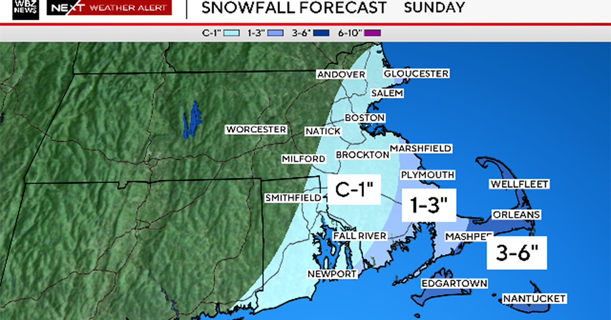
Snow could start **very early Sunday morning**, peaking through the day with 2-6 inches possible on the outer Cape and up to 12 inches if the system nudges closer. Boston faces about a 30% shot at 6+ inches, but a mere 10-20 mile shift means the difference between flakes and a half-foot dump. Gusts of **45-55 mph** loom Sunday, fueling hazardous marine swells up to 25 feet.[1][2]
Wind, Flooding, and Safety Amid the Chill
Expect **minor to moderate coastal flooding** around high tides Sunday into Monday, especially on Nantucket, alongside gale-force offshore winds. Arctic cold persists with below-zero wind chills and post-storm teens, risking frostbite in 30 minutes. Monitor updates closely as small changes could spark blizzard conditions or power issues in southeastern spots.[1][2]