First Widespread Snowfall Brings Slick Roads Across Tri-State
First Widespread Snowfall Ushers in Slick Roads Across Tri-State
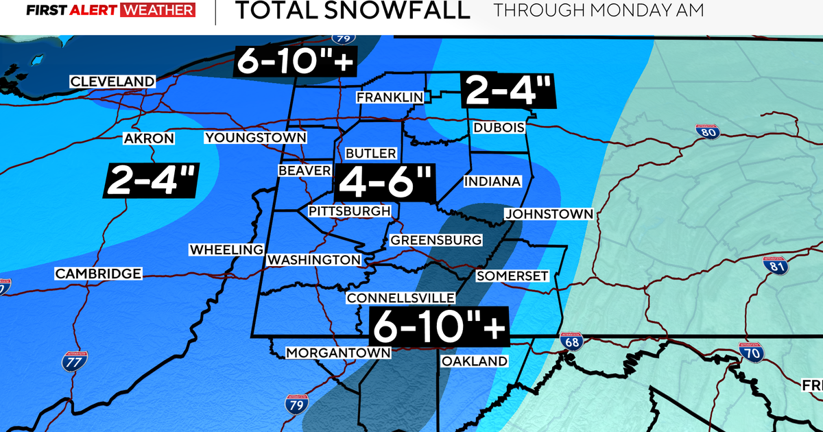
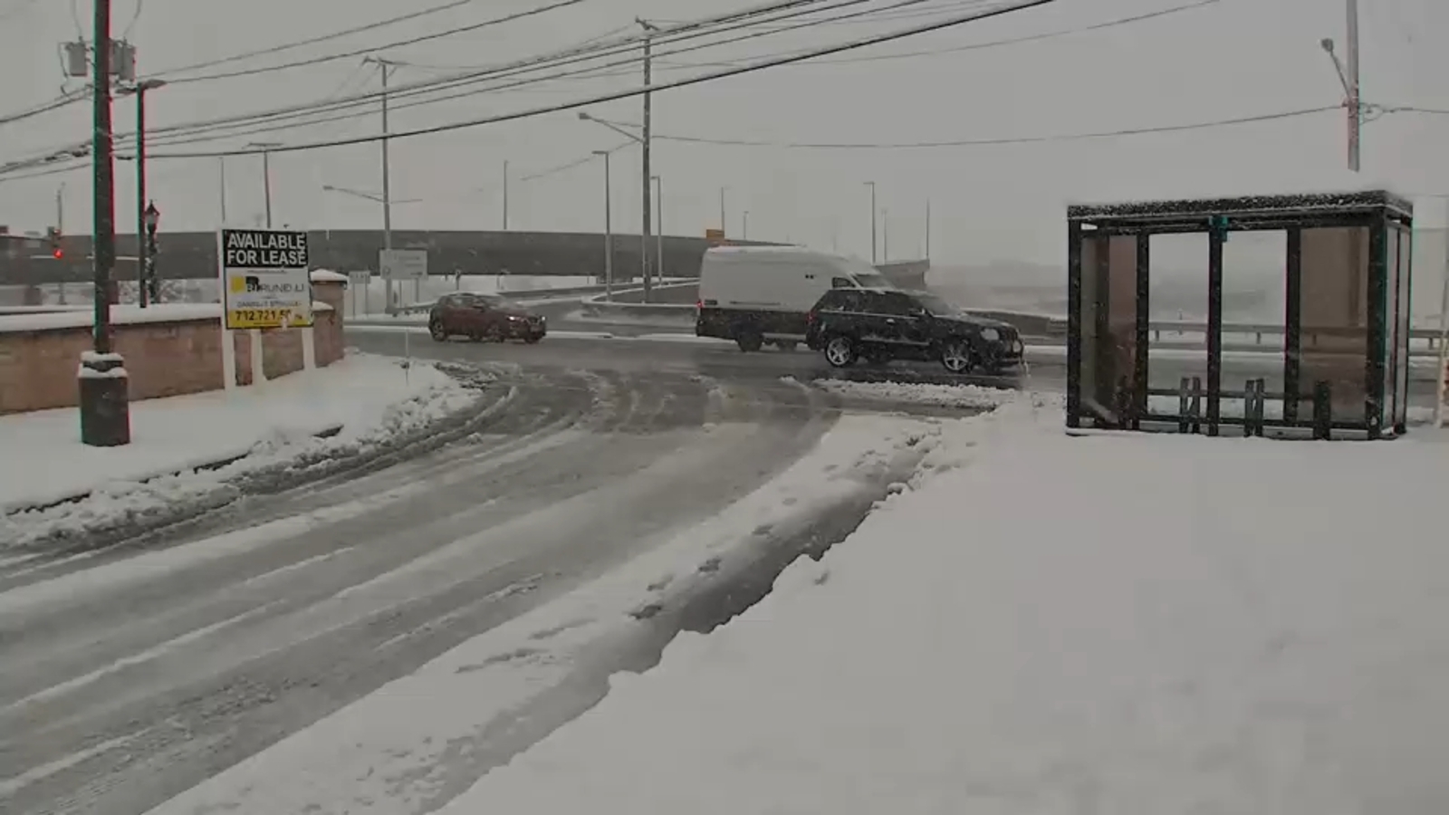
The inaugural major snowfall of the 2025-26 season blanketed New York City, New Jersey, and the Tri-State area on December 14, transforming familiar routes into hazardous paths. Issued by the National Weather Service, a Winter Storm Warning gripped parts of New Jersey, while a Winter Weather Advisory blanketed NYC and surrounding regions, signaling up to 8.6 inches in spots like Howell Township.[1] Commuters faced fluffy accumulations turning treacherous overnight.
Snow Totals and Weather Warnings
Reports highlight varied totals: Plainfield logged 4.7 inches, Springfield and Cranford 4.5 each, while coastal Cape May saw just 0.3 inches.[1][3] Northern areas along the I-95 corridor, including NYC suburbs, endured steady flakes post-midnight, promising 3+ inches that hint at a dynamic winter ahead.[2] Freezing temperatures post-storm risk icy refreezing on untreated surfaces.
Travel Impacts and Safety Tips
Monday commutes demand caution as schools delay openings to allow plowing.[1] Slick roads from NYC to NJ demand slow speeds, winter tires, and emergency kits. This early blast reminds residents to prepare shovels and check forecasts for lingering cold snaps affecting the bustling Tri-State daily grind.
About the Organizations Mentioned
National Weather Service
The **National Weather Service (NWS)** is a U.S. federal agency under the National Oceanic and Atmospheric Administration (NOAA) dedicated to providing weather, hydrologic, and climate forecasts and warnings across the United States, its territories, and adjacent waters. Its primary mission is to protect life and property and enhance the national economy by delivering timely, accurate, and science-based environmental predictions[1][2][5][6]. Founded in the late 1800s, the NWS has evolved into a comprehensive weather monitoring and forecasting organization. It operates through a nationwide infrastructure comprising 122 Weather Forecast Offices (WFOs), 13 River Forecast Centers (RFCs), and 9 specialized national centers including the National Hurricane Center, Storm Prediction Center, and Space Weather Prediction Center, among others[1][3][4]. These centers utilize advanced technology such as Doppler radars (WSR-88D), satellite data, automated surface observing systems, and sophisticated computer models to gather and analyze atmospheric data continuously[7]. Key achievements of the NWS include the development of impact-based decision support services that aid emergency management, aviation, marine operations, and the general public in preparing for hazardous weather events. The agency issues around 1.5 million forecasts and 50,000 warnings annually, significantly contributing to disaster preparedness and response efforts[4][6]. The 2011 Strategic Plan emphasizes building a “Weather-Ready Nation” by leveraging advancements in science and technology to anticipate future service needs and improve societal resilience to weather-related threats[4]. Currently, the NWS employs about 4,800 staff members and operates with a budget nearing $930 million. Its organizational structure includes a Chief Information Officer, Chief Financial Officer, and multiple operational and scientific divisions that ensure continuous innovation and service improvement. The agency’s commitment to integrating hydrologic and climate data with weather forecasting positions it as a critical player in environmental intelligence, supporting both governmental and private sectors[2][3][5