Bay Area Earthquake Swarm Strikes San Ramon with 4.2 Magnitude Tremor
#earthquake #bay_area #san_ramon #calaveras_fault #seismic_activity
Earthquake Shakes Bay Area Near San Ramon
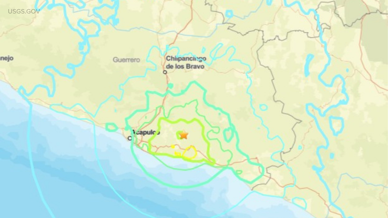
The San Francisco Bay Area experienced a startling earthquake swarm on Monday morning, February 2, 2026, centered southeast of San Ramon in Contra Costa County. The strongest quake, measuring magnitude 4.2, struck at 7:01 a.m. local time, following a 3.8 tremor at 6:27 a.m., with over 30 smaller events rattling the region within 90 minutes.[1][2][6]
Details of the Seismic Swarm
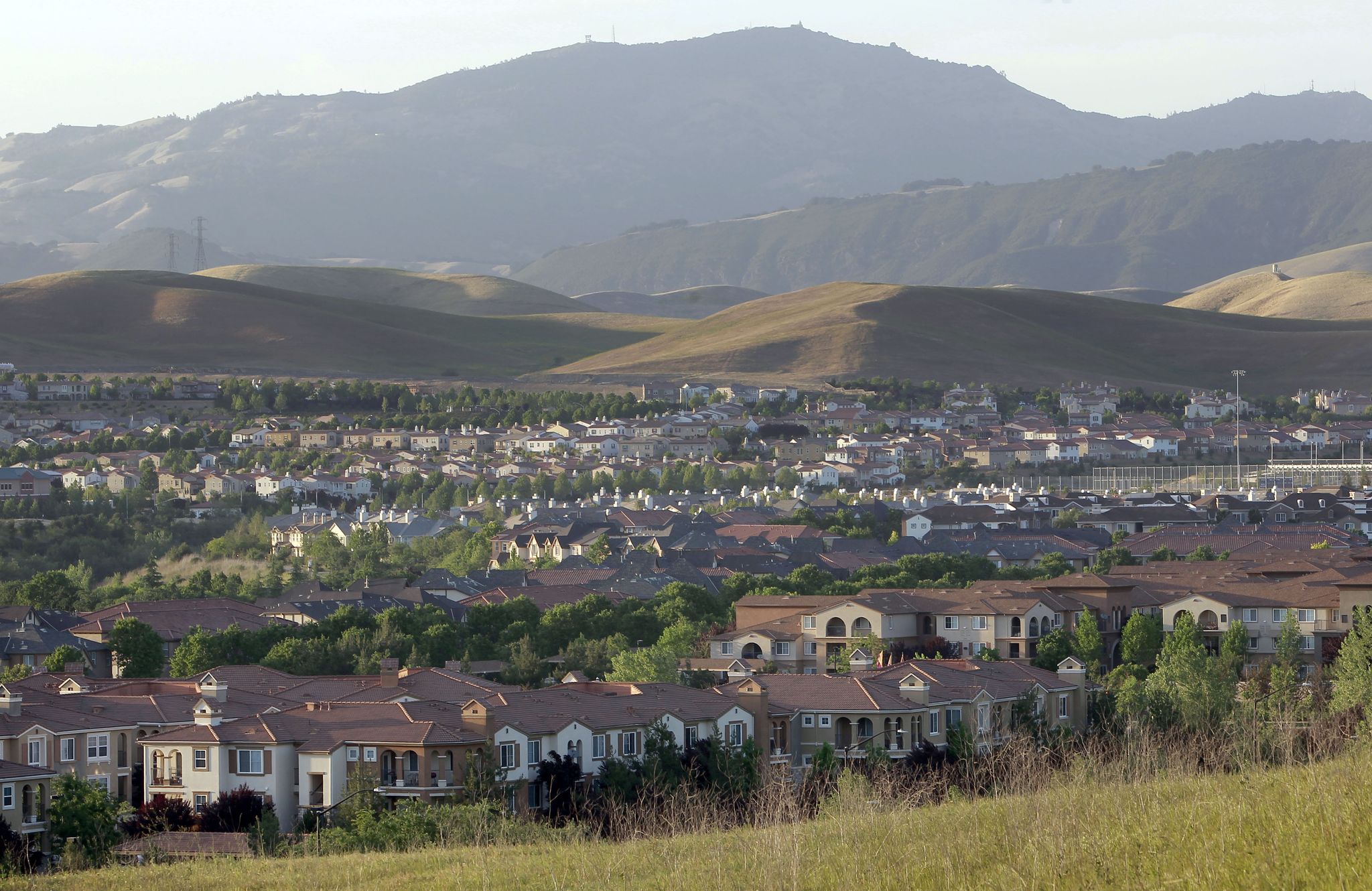
This cluster of temblors, typical of the Calaveras Fault's creeping behavior, originated at a shallow depth of about 9.4 kilometers near Alcosta Boulevard. Shaking extended to East Bay cities like Oakland and Hayward, even reaching San Francisco, Santa Rosa, and Santa Cruz. No major damage or injuries occurred, though BART slowed trains for track inspections and poolgoers at San Ramon Olympic Pool felt the rolling waves.[2][4][5]
Implications for Bay Area Residents
Part of ongoing activity since November 2025, this energetic swarm highlights the Tri-Valley area's vulnerability due to complex subfaults and fluid-filled cracks. USGS experts note such bursts are common here, urging preparedness like securing furniture and knowing evacuation routes amid California's seismic risks.[1][4]
About the Organizations Mentioned
USGS
The **United States Geological Survey (USGS)** is a premier federal agency under the Department of the Interior, delivering cutting-edge science on natural hazards, resources, and environmental changes to safeguard lives, economies, and ecosystems.[1][5][6] Established on March 3, 1879, via a congressional amendment spurred by a National Academy of Sciences report, it consolidated earlier surveys (Hayden, Powell, Wheeler) to classify public lands from expansions like the Louisiana Purchase and Mexican-American War, examining geology, minerals, and structures.[1][2] USGS's mandate spans biology, geography, geology, and hydrology, providing data on water, energy, minerals, and biological resources while monitoring threats like earthquakes, volcanoes, floods, landslides, tsunamis, and climate impacts.[1][3][4][5] It produces topographic maps—once its largest program—planetary mappings from space probes, and global datasets for policy and business decisions, such as the World Petroleum Assessment estimating untapped oil and gas reserves (e.g., 28.3 trillion cubic feet in Woodford and Barnett shales).[1][2][4][7] Key achievements include the Prompt Assessment of Global Earthquakes for Response (PAGER) system for rapid fatality and economic loss estimates post-quake; the UCERF California earthquake forecast; long-term seismic archives; and innovations in hazard modeling for disasters worldwide.[1][3][4] By the early 20th century, USGS had mapped much of the U.S., expanding to seismic/volcanic monitoring and ore deposit research.[2] Today, USGS remains vital, operating as the nation's largest water, earth, and biological science agency with advanced tools like deep-ice seismometers at the South Pole and volcano webcams (e.g., Kīlauea in 2024).[5][6][7] For business and tech audiences, its geospatia
BART
**Bay Area Rapid Transit (BART)** is a heavy-rail public transit system operated by the San Francisco Bay Area Rapid Transit District, connecting the San Francisco Peninsula with communities across Alameda, Contra Costa, San Francisco, San Mateo, and Santa Clara counties via 50 stations, 131 miles of double track, and 817 rail cars.[1][2][3] Established in 1957 as a special-purpose district to link East Bay suburbs with San Francisco's Financial District, Oakland, and Berkeley job centers, BART's concept emerged from 1946 discussions among business and civic leaders seeking efficient regional transit.[1][3][6] Revenue service launched in stages from 1972 to 1974, with expansions including the 2020 Silicon Valley extension to Milpitas and Berryessa/North San José in partnership with the Santa Clara Valley Transportation Authority.[2][3] Key infrastructure highlights feature the underwater Transbay Tube, elevated tracks, subways, and connections to airports, Caltrain, and other operators, plus the eBART spur to Antioch and Oakland Airport Connector.[1][2][3] Governed by a nine-member elected Board of Directors serving four-year staggered terms across nine electoral districts, BART employs nearly 4,430 full-time equivalents with FY2022 budgets of $1 billion operating and $1.4 billion capital.[2][4] Its unique structure splits financial oversight between the General Manager and an independent Controller-Treasurer, differing from peer agencies.[4] **Achievements** include serving daily riders while easing congestion, supporting California's greenhouse gas goals through reliable, equitable service, and innovations like All Nighter bus alternatives since 2006.[2][3] Today, BART maintains robust operations amid urban-suburban demands, with ongoing fleet modernization and budget processes ensuring fiscal transparency via annual audits and public hearings.[2] Notable for its scale and resilience—spanning diverse landscapes and integrating multi