Boston Snow Forecast: Two More Flurries After Blizzard of 2026
Snow Again? Boston's Forecast Signals Two More Flurries
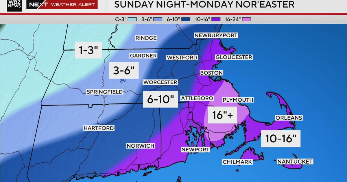
Just days after the devastating Blizzard of 2026 dumped over three feet in southeastern Massachusetts and 17 inches in Boston, weather maps reveal two upcoming chances for light snow accumulation.[1][2][4] This minor resurgence follows widespread power outages, school closures, and a travel ban, marking the city's first above-average snowfall season in four years with totals exceeding 60 inches.[1][4]
Wednesday's Quick Snow Event
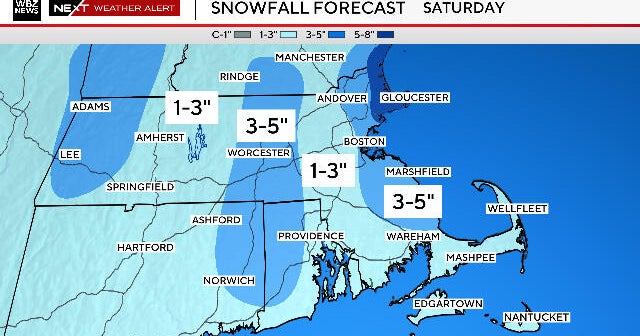
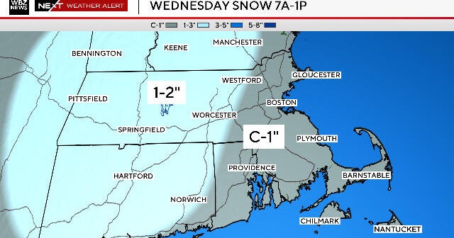
Today, Wednesday, a 4-to-6-hour window of light to moderate snowfall targets Massachusetts, starting around 7 a.m. in Worcester County and spreading east by 9 a.m.[2] Expect a coating to one inch in Boston and eastern areas, with 1-2 inches west of Route 495; some roads may slicken before melting under afternoon sun and upper-30s temperatures.[2] A touch of rain might mix in along the South Coast.
Thursday Night Possibility and Warmer Ahead
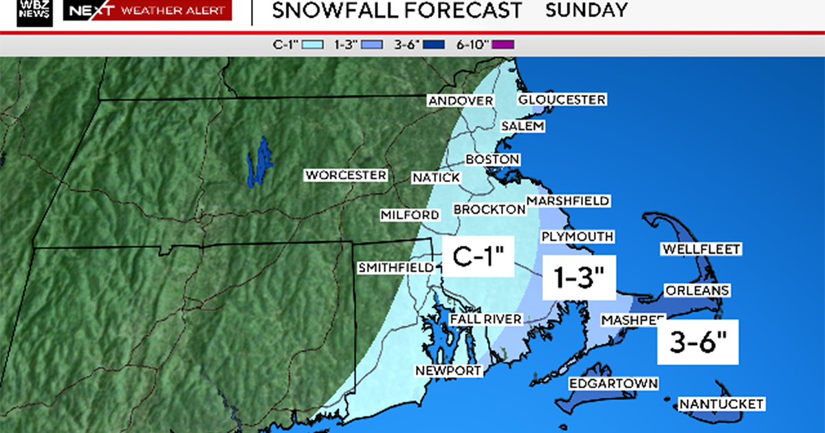
Thursday night brings a slim chance of very light snow from a southern storm's fringe, though most models predict a miss.[2] Relief arrives over the weekend with near-50-degree highs on Saturday, aiding cleanup from this relentless winter.[2]