California Storm Timeline: Severe Impacts, Floods, and Snow Ahead

California Storms Are About to Hit: A Timeline of Severe Impacts
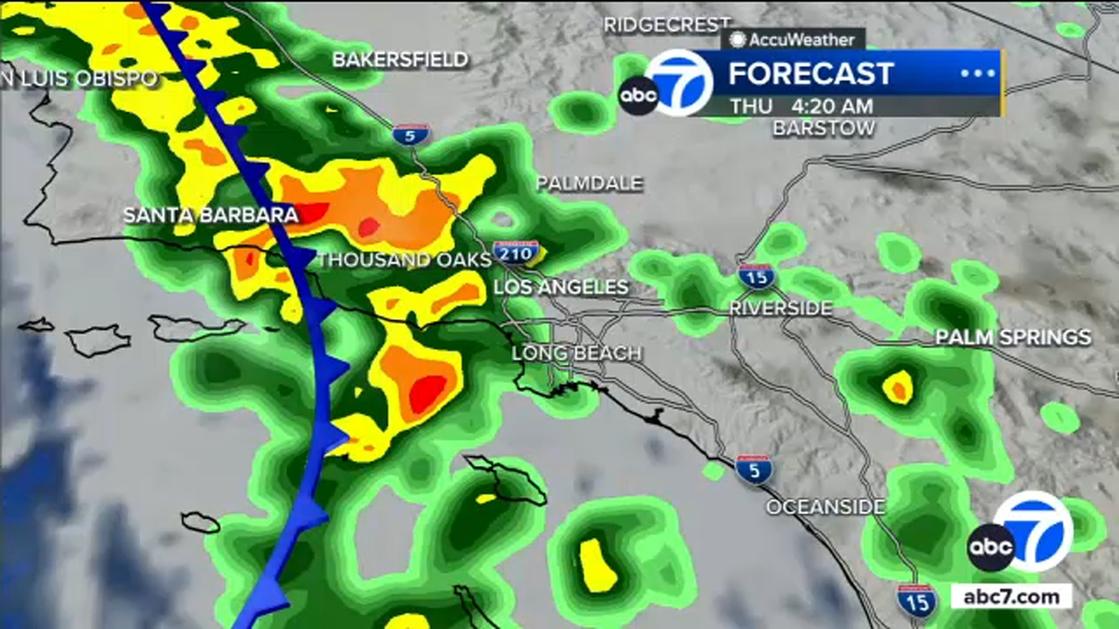
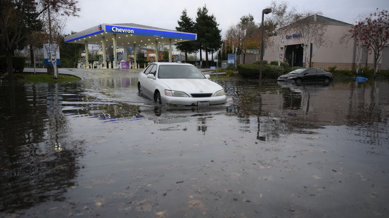
California braces for back-to-back storms unleashing heavy rain, flooding, snow, and fierce winds from San Francisco to Los Angeles. Starting Sunday evening, the coldest system of the season slams Northern California with 2-3 inches of rain in the Sacramento Valley and up to four inches in foothills by Wednesday. Bay Area downpours begin noon Sunday, sparking coastal flood advisories through Tuesday amid high tides and storm surges.
Peak Intensity: Monday Through Wednesday
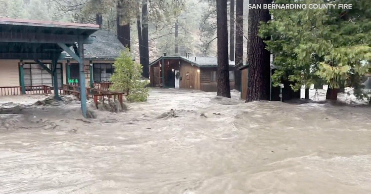
Monday brings treacherous thunderstorms, gusts to 50 mph, and wind advisories until Wednesday night. Sierra Nevada faces winter storm warnings above 2,000 feet, with snow levels plunging to 1,500 feet Tuesday and possibly 1,000 feet overnight. Up to 8 feet of snow buries mountains, causing low visibility, impassable roads, and chain controls. Southern California sees flash floods in Los Angeles County, evacuation warnings near wildfire scars, and tree falls blocking highways like US-101.
Preparation and Ongoing Threats
Officials urge avoiding flooded roads—12 inches of water can sweep vehicles away. Additional systems loom late week, promising more snow and low-elevation flurries. Emergency crews stand ready for mudflows and disruptions, reminding residents winter's grip lingers despite spring-like hints.